By Robert Graham
Invasive species management is always going to be a labor intensive, multi-year project no matter the scale at which work is being done. Unfortunately, one of the primary roles of conservation organizations today is fixing the last 400 years of ecological damage caused by previous land management activities. Here at the Norcross Wildlife Foundation, we have the privilege of protecting over 8,000 acres of total land. Close to 5,000 of those acres are contiguous and thought to be the largest block of privately owned land in Massachusetts. With land holdings like that, it is difficult for our seasonally fluctuating 10 person staff, and many organizational partners, to make large restorative impacts without a systematic and organized habitat management and invasive species management plan. Luckily, we’ve recently taken some steps to revamp the way we identify, plan, and record invasive species management activities across our landholdings
Initial detection and documentation
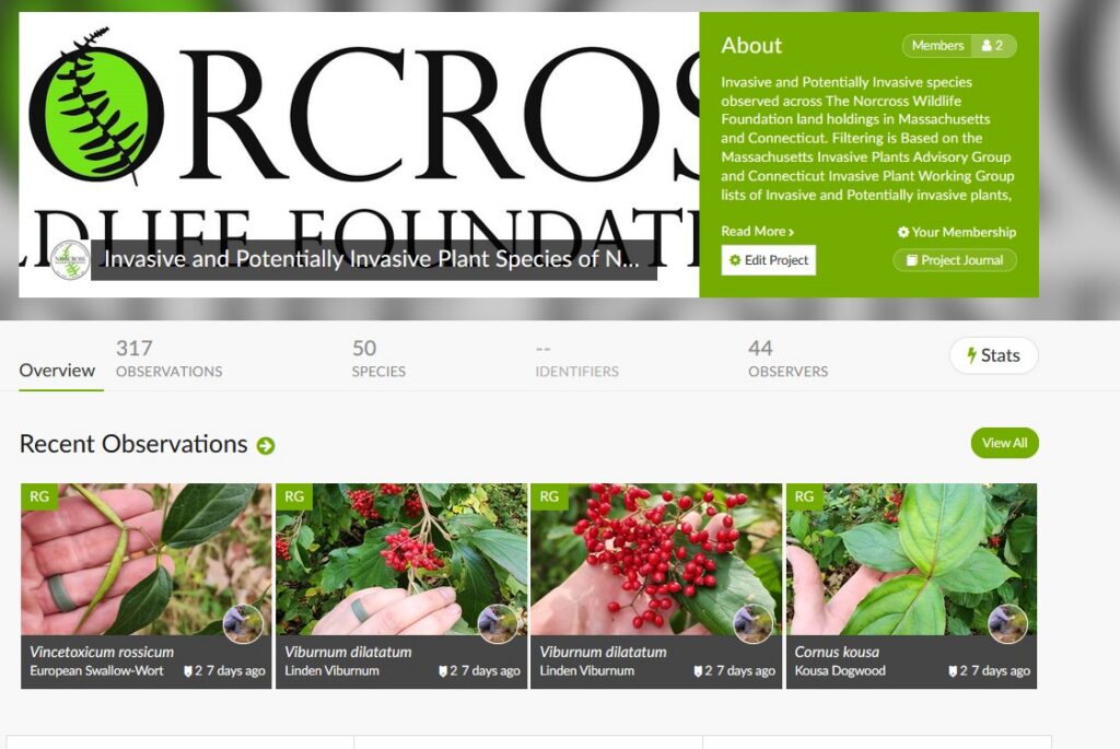
With so much acreage to cover, it can be difficult for Norcross staff to even begin to understand where we have invasive species in the core habitat and across the multiple satellite properties we manage without sending staff out or having contract botanists explore those properties and document their findings. The easiest way for us to be able to get a basic idea of where invasives can be found is by using already available data generated by other community scientists who have been to those parcels either through events held by Norcross, or while they are doing contracted work. iNaturalist projects are a great way to filter for problematic invasive species because they can have project limits set to the boundaries of the properties being managed. Our iNaturalist project has already led to the early detection of Rubus phoenicolasius (wineberry) in an area nobody would have ever seen — buried in mountain laurel along the road system. Thanks to an iNaturalist user, we were able to pinpoint its location, track its origin to contaminated mowing equipment, and isolate that invasion.
GIS, density mapping, and planning 20 years ahead
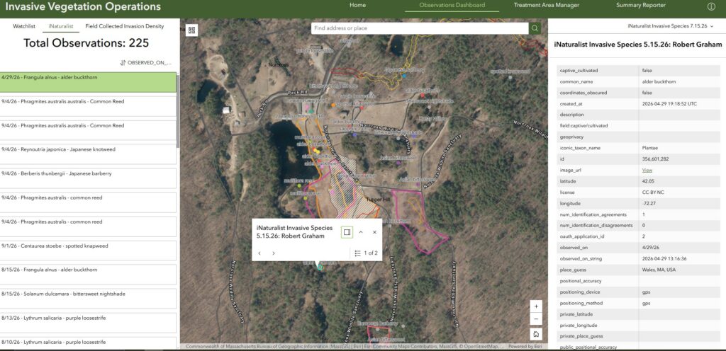
One of the most important changes we’ve made at Norcross is utilizing GIS (Geographic Information System) to add spatial data to our invasive species management program. We started with the Invasive Vegetation Management Solution created by ESRI for their platform ArcGIS. This pre-made packaged solution allows for easy early detection of invasives and mapping of planned management activities and treatment areas. We’ve modified the original solution to incorporate iNaturalist data, as well as on-the-ground invasion density maps created by Norcross staff to assist with prioritizing invasive treatment areas. The ability to filter by year with this solution allows us to have layers of overlapping data that is still seamless and in one place, even with planning for invasive management activities 10 years down the line.
Permitting, contracting, and executing
When working at scale, some of the biggest hurdles include relying on the timelines of permits required for wetland work, organizing and budgeting with contractors, and getting those contracts on-site to do work within the proper treatment window. As is the case with many properties, some of our most invaded areas are wetlands due to their frequent disturbance, seasonally exposed soil, and lack of competition from native plants. Our current invasive management focus is on one of our most involved habitats activities, the restoration of Vinica Brook, one of the largest inland river restorations in Massachusetts. With the removal of nine dams, the reconnecting of 10+ miles of stream habitat, and restoration of 300+ acres of wetland complex, there is significant new exposure of disturbed soil that risks novel invasion from the thousands of well-established invasives already surrounding the area. One of our priorities prior to the novel soil disturbance from the restoration was to treat the most well established, extremely dense invasions along the length of the area.This ultimately worked out to be a roughly 35 acres area of treatment just for the invasives in the wetland boundary.
For us here in Massachusetts, our work around wetlands is subject to the Wetlands Protection Act, where generally any work within the 100’ buffer (or 200’ buffer in a rivers area) is subjected to filing a Notice of Intent through MassDEP and the local conservation commission for approval. The 2026 treatment of invasive along Vinica Brook came to a total treatment area as follows:
Total Riverfront Impact: 8.89 acres (387248.4 sqft.)
Total impact in 100′ Buffer: 4.9 acres (213444 sqft)
Total Impact in 200″ Buffer: 3.99 acres (173804.4 sqft)
Total Riverfront Area in Project: 34.76 acres (1514145.6 sqft)
Total BVW Impact: 0.84 acres (36590.4 sqft)
Wetland permitting wasn’t the only permitting process this project required for the 35-acre invasive species treatment, Norcross has the benefit of protecting dozens of Estimated Habitat of rare species that are regulated by the Massachusetts Natural Heritage and Endangered Species Program. Parts of our proposed treatment area fell within those areas of Estimated Habitat of Rare Wildlife and required an (Appendix B) Detailed Habitat Assessment Evaluation. All of this to say that our site evaluation for invasive species management started in April 2026, but work wasn’t able to begin until September 27, 2026, roughly the last few weeks of the application window for large droplet foliar application. This ongoing large scale invasive species management plan will follow this protocol:
1. Initial detection of invasive species through iNaturalist, or staff observation
2. Invasion density, and boundaries of invasion recorded in the field using ArcGIS
3. Determination of management priority, and assigning a planned treatment timeline for documented invaded areas
4. Determining potential permit requirements of management given population (wetland Buffer, rare species habitat)
5. Receive quotes from invasive species contractors, order them in management priority for budgeting
6. 1+ year in advance, begin permit application process for required populations
7. With permits approved, schedule management activities based on treatment windows (treatment method and species will determine this)
8. Document boundaries of treatment and efficacy in the weeks following treatment
9. Assign site re-check dates, to determine following season treatment efficacy as well as in determining follow up treatment requirements
10. Prioritize ongoing treatments before beginning new ones and manage permits budget and project priority with ongoing active management activities
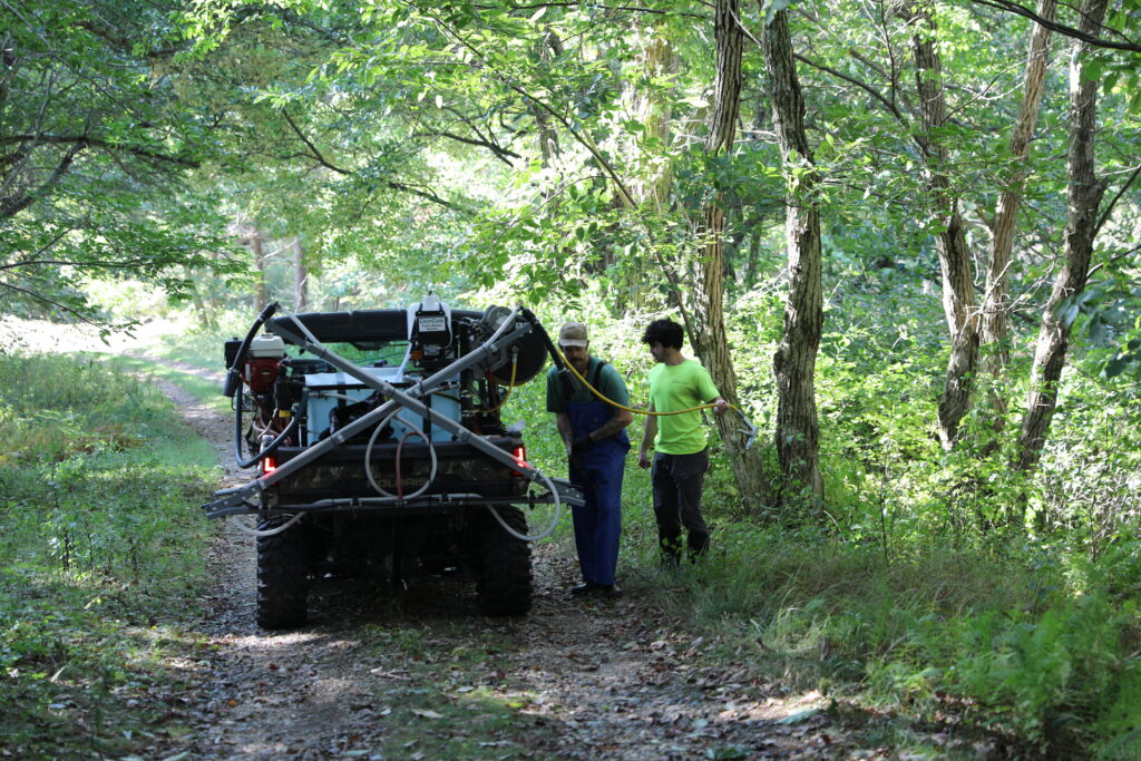
In many ways, the actual treatment of invasive species on a large scale is the simplest part of the invasive species management plan while having more involved permitting and documentation is by far the most important in order to complete the plan. Without proper documentation and organization, treatments get forgotten, and follow ups are never done. Treating a population of invasive species rarely ever is fully successful the first time. Without follow up treatment, a population will simply rebound back to its previous volume in no time. The treatment manager’s job comes to juggling projects, permits, priorities and all the other ongoing scheduling conflicts that come with large scale projects. At Norcross, we work diligently to be organized and plan our habitat management and invasive species management priorities 5,10 to 30 years in advance across our properties. With the tools we have available to us today as conservation organization members, it has never been easier to stay on top of invasive species management.
Robert Graham is an ecologist, horticulturalist, outdoorsman and botanist. He is currently the Natural Areas Manager at the Norcross Wildlife Foundation. His work ranges from habitat restoration and invasive species management to sustainable equipment and arboriculture. Robert serves as the vice chair of the Native Plant Community for the American Public Garden Association, and frequently teaches and volunteers for organizations like the Ecological Landscape Alliance, New England Botanical Society and the Native Plant Trust.